Advertisement
To understand why Long Island Sound is one of the best — and more challenging — cruising grounds in America, it helps to think big. Glacier big. Eons ago, ice a half-mile-thick covered present-day Connecticut and New York and ground to a halt here at the end of the last Ice Age.
As it slowly and sporadically retreated, the glacier's meltwater deposits, known as drift, created one of the biggest tidal estuaries (mixed fresh- and saltwater) on the East Coast. About 113 miles long and 21 miles at its widest point, Long Island Sound is known for its complex underwater geography, mythical tidal currents, and rich fishing grounds. With 600 miles of coastline stretching from New York City to the eastern edges of sandy Long Island and the rocky southern Connecticut shoreline, it offers endless places for both sail- and powerboats to explore, especially at its eastern end.
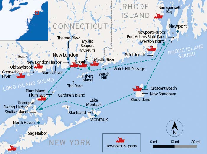
The variety of boating and destinations here is amazing. Remote, laid-back, and beautiful Block Island, off the eastern tip of Long Island, is one of the top cruising destinations on the eastern seaboard. The Race and Plum Gut off the North Fork of Long Island, where fierce tidal currents are violently squeezed in and out of the Sound twice a day, are legendary for their rough water and great fishing. On Connecticut's south shore (up Mystic River), you can explore historic wooden ships at the Mystic Seaport Museum, or (up the Thames River) watch sinister-looking modern nuclear submarines transiting the Navy's primary East Coast sub base at New London.
Mix in Atlantic wind and swells from the east, countless recreational boats (especially on summer weekends), big-ship commercial traffic (at any time), and occasional fog (common in July and August), and you'll need to stay alert at the helm — and pay attention to tidal currents. But especially in the eastern half of the Sound, a sheltered gunkhole is never too far away when the wind or weather kick up.
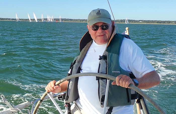
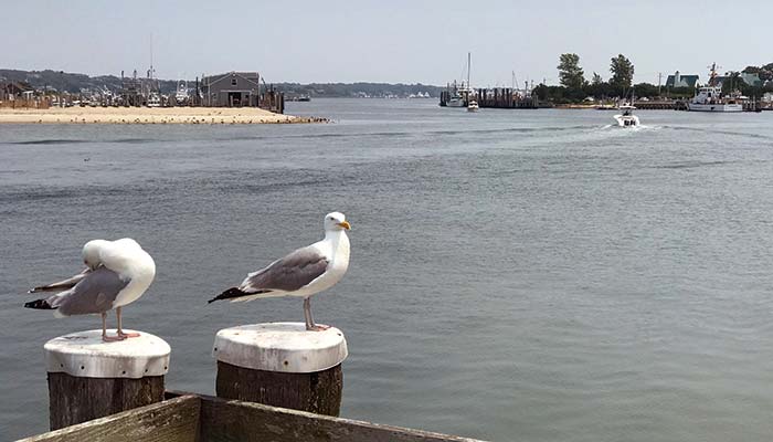
Dwight Merriam, retired Navy captain and Connecticut sailor, leads the pack across Long Island Sound. (Photo: Stephen Blakely)
"What's remarkable about the area are the short legs between strikingly different places. In 15 or 20 nautical miles, you go from cityscapes and busy coastal harbors to places where few if any other boaters are to be found," says Dwight Merriam, a Connecticut lawyer and Navy vet who's sailed Long Island Sound for more than five decades. "There's excitement if you want it, but also so many little places to tuck in, both gunkholing and small harbors with deep water."
Heading Out
Charter boat companies offer a flexible range of cruising itineraries to suit their customers' time and interests on the water. For our Long Island loop, we chose to charter in nearby Newport, Rhode Island, a legendary nautical town worthy of its own story, because it worked best logistically for our crew. We opted for a clockwise route, heading south down Narraganset Bay, past sprawling mansions with acres of perfect lawns, bound for Rhode Island's Block Island as our first stop. Our boat is a Beneteau 44 named Summer Dreams.
The sheltered waters of Narraganset Bay come to an end soon after leaving Newport Harbor. As you pass Brenton Point to port and Beavertail Lighthouse to starboard, you enter the open and typically bumpy sea of Rhode Island Sound, and I soon regretted my big breakfast. But we were making good time, had clear weather, and only 17 miles to the lee of Block Island. We soon motored into the island's well-protected Great Salt Pond on the west side. A crisp red-and-white Coast Guard station near the mouth of the harbor greets inbound boats.
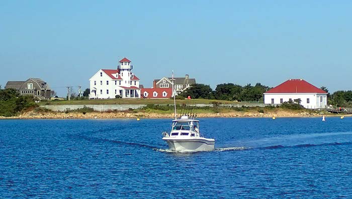
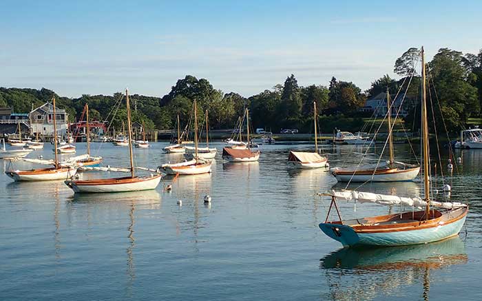
Area boaters head to "The Block," Rhode Island's Block Island, 13 miles off the coast and home to a well-marked and lively harbor. (Photo: Stephen Blakely)
Block Island is the quintessential summer retreat, and in full season its harbor is jammed with cruisers, ferries, and commercial fishing boats. Its population triples over the summer, and on busy weekends some 1,500 boats somehow squeeze into Great Salt Pond. But with only 90 transient moorings available to visiting boaters (the lime green ones, owned by the town), be prepared to drop the hook if you don't have a reservation. And be careful if you do, as swinging room is tight and holding in the outer anchorage is poor.
Among the many delights of Block Island is its laid-back vibe, beautiful dunes, rolling moors, high cliffs, and easy accessibility. Only 5 miles long and 1 mile wide, you can explore it by bike, moped, or even on foot. (Don't miss Crescent Beach on the east side, one of the best in New England.) There are two historic brick lighthouses still active, both open to visitors: Southeast Light located on Mohegan Bluffs (the most popular tourist attraction on the island) and North Light, with a small museum.
"Block Island is really a throwback to an earlier time. There are no traffic lights, about half the island is conservation reserve, there are no chain stores or McDonald's," a volunteer at Southeast Lighthouse told us. "We like it that way."
Guides & Discounts
- "The Cruising Guide to the New England Coast," Duncan, et al
- "Waterway Guide, Northern" (BoatUS Members receive 20% off all Waterway products with code BOATUS20)
- Dockwa marine dock/slip/mooring reservations app (BoatUS Members receive free bookings at participating marinas)
- Visit BoatUS.com/Maps or download the BoatUS App to search for exclusive BoatUS Member discounts on transient slips, services, gas, and more.
Montauk
The next day we motorsailed in light winds 26 miles southwest to the South Fork of New York's Long Island, passing Montauk Point Lighthouse at its eastern tip to port and entering nearby Montauk Harbor, with packed fishing docks to starboard. (It's the largest commercial and sporting fish harbor in New York state.) We took the port channel around the recreational boating hub of Star Island and motored down to the remote southern end of shallow Lake Montauk (hug the channel markers closely and mind the tide), where our little fleet anchored for the night. We kicked back in the warm fall sun and swam off the stern in the brisk Atlantic seawater. That evening, dinghies snaked through the fleet to share group dinners aboard, one of the few nights we did not dine ashore
On Montauk's north side, the harbor area is home to a bustling fishing fleet and just steps from waterfront dining, shopping, and basic angler's lodging. (Photo: Rich Armstrong)
Shelter And Gardiners Islands
Our third day involved a motorsail through light northwest winds to the charming and historic summer enclave of Shelter Island. In colonial times the island was a key harbor for ships in the Triangle Trade between America, Caribbean slave plantations, and Britain.
Tip
Shelter Island is nestled between the North and South forks of Long Island and provides the only link between them, via two small car ferries, to the towns of Greenport above and North Haven below. With five good harbors, Shelter Island is a popular rendezvous destination for yacht clubs and cruisers. Just south of Shelter Island is Sag Harbor on the South Fork of Long Island, popular with both boat and land-yacht tourists. The Sag Harbor Whaling and Historical Museum is a must-see.
Shelter Island Yacht Club Dering Harbor, New York. (Photo: Stephen Blakely)
Just south of Shelter Island is Sag Harbor on the South Fork of Long Island, popular with both boat and land-yacht tourists. The Sag Harbor Whaling and Historical Museum is a must-see.
Crossing The Sound: The Connecticut Coast
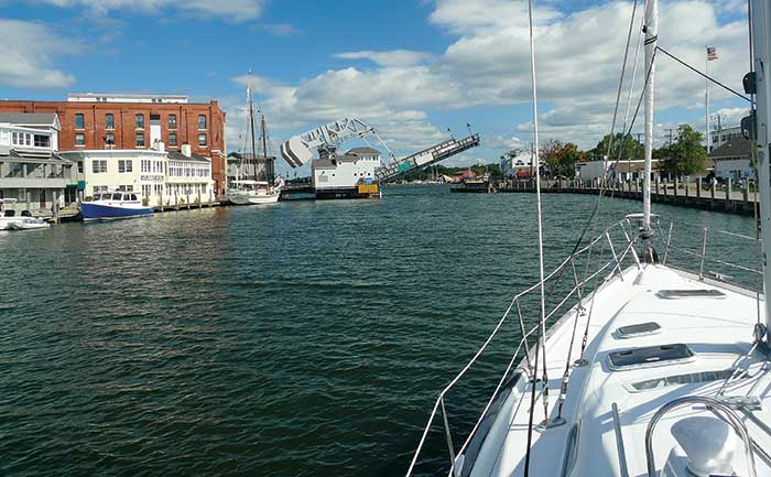
The following day we crossed Long Island Sound bound for the Connecticut River. This required carefully timing the tide to transit Plum Gut, the narrow and treacherous passage between Orient Point (the tip of the North Fork of Long Island) and legendary Plum Island.
Plum Gut passage, as "The Cruising Guide to the New England Coast" describes it, "is a vicious piece of water, where seven currents come together and can form a tide rip that can run as high as 10 knots." Adding to the navigational challenge is the New London-Orient Point car ferry that runs through the Gut several times each day. Various other ferries cross Long Island Sound, too, especially to Block Island, so keep an eye out. Of particular note are the high-speed power catamaran ferries that cruise at 15 knots and can sneak up on an unobservant boater.
Tip
We had good timing and a glorious sunny day for this leg, with a perfect northwest breeze. The tidal current shot us through the roiling waves as we headed upwind to a small yacht club in Old Saybrook, Connecticut, 10 miles to the north across the Sound. It was the most magnificent sailing of the entire voyage.
The entrance to the Connecticut River is well-marked with two breakwaters and lighthouses befitting the waterway's status. This is the largest source of freshwater entering Long Island Sound and a cruising destination by itself, stretching 400 navigable miles north to the Canadian border. But with a deep current, sometimes opposing tides and wind, shoals, and crossed by various highway and railroad bridges, this seemingly calm river can be tricky due to the strong outgoing flow. The east side of the lower river is shallower and dotted with the remnants of old piers just below the surface.
One of the most popular destinations just up the Connecticut River is the historic harbor town of Essex, a major boatbuilding center in the 1700s with beautiful architecture, cobblestone streets, and genuine colonial charm. Essex is consistently ranked as one the 100 Best Small Towns in America and is a great walking town. The historic Griswold Inn, or "The Griz," was built in 1776 and has a great tap room with a wood stove and occasional piano player.
Mystic Seaport
Returning to the Sound the next day, we turned east for our last destination, north up the Mystic River. The Connecticut shore is dramatically rockier, more complex than New York's sandy Long Island coast, with submerged ledges, small islands, and busy harbors that demand constant attention. This route has several inviting attractions we had to pass without stopping, such as the Niantic River (crossed by a busy Amtrak Bascule Bridge that must be raised to clear anything more than 16 feet) and Thames River farther east. Busy New London Harbor is home to the U.S. Coast Guard Academy, the Navy sub base (dating to 1915), and the USS Nautilus Submarine Force Museum. Keep an eye out for subs while passing New London.
The Mystic River Bascule Bridge was built in 1922 and has a clearance of just 4 feet. (Photo: Stephen Blakely)
Due south of Thames River is "the Race," the short, steep, and deep underwater funnel that squeezes and accelerates powerful tides between Long Island Sound and the open Atlantic. It's marked by Race Rock Lighthouse and is renowned among boaters for its strong rips, standing waves, heavy winds, and traffic. Well-powered motorboats can fight the currents here, as many fishing boats do chasing striped bass and other types of fish that feed in the fast flow. But sailboats must catch a slack or fair tide to get through. The Race is ranked as the second-most challenging cruising water in the Northeastern U.S. (Hell Gate in New York's East River is No. 1), according to CoastalBoating.net.
We avoided The Race entirely by hugging the Connecticut shore, heading east above Fishers Island, and slipping into the mouth of the Mystic River at the town of Noank. A meandering channel takes you past several picture-postcard villages and many packed marinas to the Mystic Seaport Museum. This trip is often delayed by both a pivoting railroad bridge and a small drawbridge just before reaching the museum.
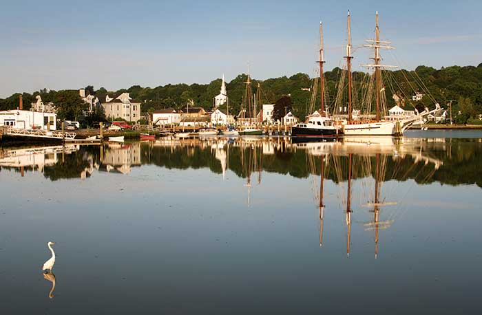
Mystic Seaport, in southeastern Connecticut, is known for its maritime heritage, historic ship-captains’'homes, and excellent dining. (Photo: Getty Images/Denis Tagney Jr.)
But when you clear that last bridge, you enter another era. On the banks of a calm harbor is the Mystic Seaport Museum complex, a meticulous restoration of a 19th-century whaling village with one of the best and most active wooden boat restoration shops in the nation. Among its many historic vessels, the jewel in the collection is Charles W. Morgan, the last surviving 18th-century whaling ship, which recently underwent a massive refit. Every summer, the deck of the Morgan becomes a stage for the annual Moby-Dick Marathon — a nonstop 24-hour reading of Herman Melville's masterpiece.
Our fleet tied up at the museum's marina for visiting boats, which gave us a special treat: private access at night to the museum grounds, historic ships, and buildings after all the busloads of tourists were gone. It's easy to be transported back in time during the day by all the haunting old ships, vintage shipwright stores, and volunteers wandering around in period costume. Alone in the quiet darkness (and occasional fog), it can be ghostly.
Back To Newport
For our last day at sea, we motored south back into the Sound, east-northeast to hug the coast back to Newport. The two big waypoints along here are Watch Hill Passage, another area of strong rip currents. The cruising guide notes that navigation buoys here sometimes disappear: At maximum flow, the rip will pull cans 3 and 5 entirely underwater.
As you pass Watch Hill, the most prominent building is a white mansion on top of the hill, protected from the sea to the east by a fortune's worth of rip-rap. That's Holiday House, the 11,000-square-foot, 8-bedroom retreat of singer-songwriter superstar Taylor Swift when she's not touring.
At the start of a voyage, Newport Harbor is always an exciting place, but at the end of a voyage, swinging on the mooring, watching the sun go down over the water, and reflecting on our adventures, it was a cozy, rewarding, and even nostalgic place — even before we jumped in the dinghy for the last time and returned to land.