Advertisement
The region's abundant natural beauty is a legacy to be shared among boaters, fishermen, watersports fans, and nature lovers.
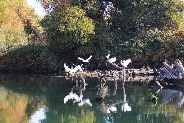
Snowy egrets rise to pursue breakfast. Our boat has startled some fingerlings right toward this flock of snowy egrets that had been hunting among snags piled up in a glossy bend on Steamboat Slough. Around the next bend you may see great egrets, little blue herons, sand hill cranes, and Canada geese — all at home in the Delta wetlands. (Photo: Pat Rains)
The Delta is California's wet and wild heartland: Six rivers cascade out of the snowcapped Sierra Nevada range and merge in the central valley to form 1,000 miles of recreational waterways. Now tamed by dams and levees, this labyrinth of navigable streams entwine 57 islands full of state parks, vineyards, and Gold Rush villages before flowing down to San Francisco Bay. Only a few miles southwest of Sacramento, the state capital, the Delta region is surprisingly rural and sparsely populated. It's like stepping 50 years into the past. Yet 40 small marinas and 100 launch ramps thrive along the tree-lined channels and tranquil river bends. From a boat, it's like gliding through a forest.
Very few roads transit the Delta; some of the more remote islands are accessible only by boat. Others, like the Brannan Island State Recreation Area, are popular destinations. Near every cluster of docks and free anchorage areas, boaters seem to find something of interest: a woodsy little restaurant open for breakfast, an RV camp with cabins, an 1860 gold baron's mansion recently converted from a museum to a wine-tasting lounge. A four-car cable ferry and a drawbridge still operate on call; if you can't raise the tender on VHF Channel 9, just toot your horn "one long, one short."
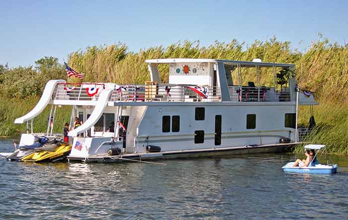
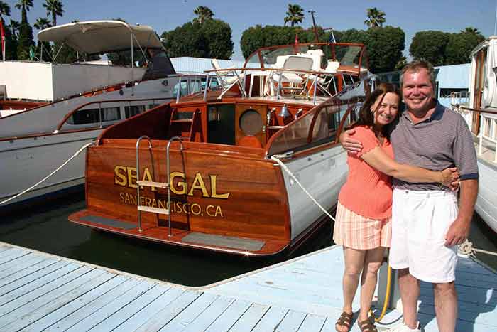
Vacation houseboat rentals are popular in the California Delta, like this family sized double-decker on the San Joaquin River that comes with lots of toys. (Photo: Gene Beley)
That low-key charm is what attracts boaters here to cruise, fish, water-ski, paddleboard, kayak, or do some casual sightseeing. Families with children spend annual vacations on their favorite sections of the rivers; years later, their grown kids come back to share it with their own families.
Sacramento Delta Facts
- The Sacramento is the largest river in California, with a watershed of 27,500 square miles.
- There are 170,400 registered boats spread among the 515,264 adult full-time residents of the Delta region, reported the California Department of Water Resources in 2000.
- The Delta is the physical hub of California's two largest water-distribution systems, which supply drinking water to 24,835,970 people, or two-thirds of the state's population, and irrigation water for over 7 million acres of farmland.
- The most popular recreational activities in the Delta are boating, fishing, leisure cruising, wakeboarding, waterskiing, swimming, and bird watching. The Delta is home to hundreds of wildlife species and is a part of the Pacific Flyway, providing critical habitat for thousands of migratory birds, including sandhill cranes.
Enjoy It Year-Round
Pleasure boating is a year-round passion in the Delta. Spring, summer, and fall are the best times to water-ski, cruise the countryside, and visit the vineyards, but striped-bass fishing reaches its peak during May and November, when the fish migrate through the Delta en masse. Summers can be hot as an aft-deck barbecue, so we like to anchor in the shade of giant sycamores that top the levees, such as along Andrus Island. (See map below.) Fourth of July fireworks draw hundreds of spectators to the beaches and anchorages around the tip of Mandeville Island, on the San Joaquin River. For waterskiing, check out the three-mile stretch south of Courtland, where the Pear Festival is held.
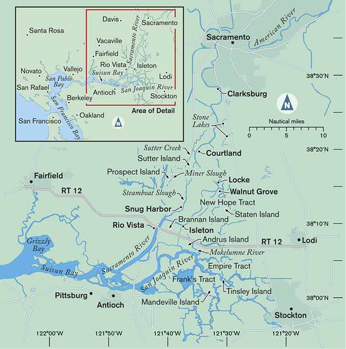
Map: ©2016 Mirto Art Studio
Winters are mild enough for wakeboarding events to be held at Snug Harbor, on Steamboat Slough. In September, the king salmon arrive to spawn in the pristine headlands of the Sacramento and Mokelumne rivers. Shad also migrate into the San Joaquin in spring, but sturgeon and three kinds of bass (striped, largemouth, and smallmouth) are permanent residents. The Thunderboat Races roar into Isleton each October. More than 20 yacht clubs are active year-round, but they put on end of year Holiday Lighted Boats Parades and traditional Opening Day Regattas just for fun.
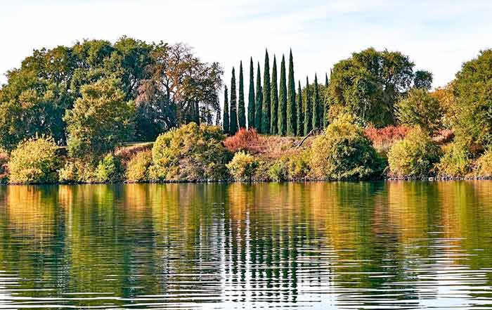
Autumn brings a brilliant change in the foliage, here reflecting across one of the Delta's tranquil waterways. With the kids back in school, some couples favor this colorful season to visit the Delta. (Photo: Pat Rains)
Spring and fall have lots going on ashore, too: the annual Asparagus Festival (Stockton), the Pear Festival (Courtland), the Crawdad and Cajun Festival (Isleton), the Chinese Heritage Festival (Locke), and vineyard flowering and grape-harvest festivals at several wineries in Lodi and Clarksburg. Raised levees protect most islands' interiors for agriculture: pecan and pear orchards, wine vineyards, and vegetable gardens. Farmers set up market stands on Brannan Island and elsewhere to sell their veggies, cherries, pecans, honeys, and jams — all "Delta Grown." Canada geese vacation here by the thousands in the fall, when the sycamores turn to gold and the Sierra Nevada gets it first dusting of snow.
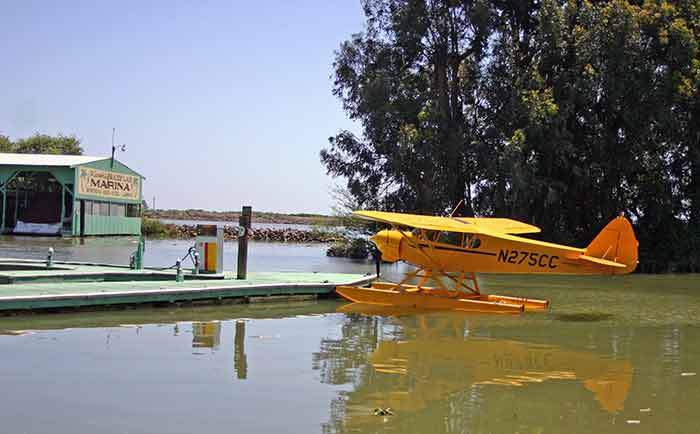
Seaplane tied up at Korth's Pirates Lair Marina, along the banks of the Sacramento River, one of almost 100 marinas in the Delta. (Photo: Gene Beley)
Getting There
The roughly triangular Delta region touches five counties and is bounded by the towns of Antioch, Rio Vista, Sacramento, and Stockton. Locals refer to the lower, middle, and upper Delta, meaning depths as well as north-to-south orientation. You can rent or charter a wide variety of boats in the Delta, ranging from bass skiffs and ski boats to shady pontoons, posh houseboats, and more. And that's a great plan for sampling the Delta for your first time, especially the middle and upper reaches, such as around the region known locally as the "Delta Loop" and up to Walnut Grove and Locke. But eventually, most vacationers get there with their own boats.
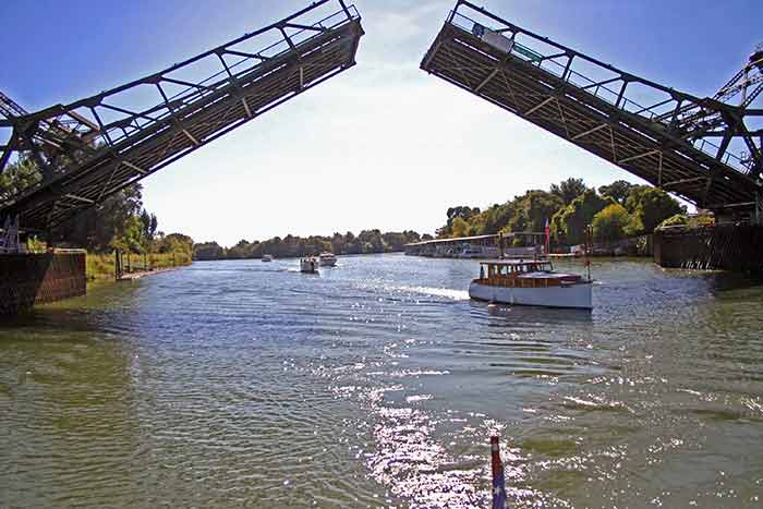
Walnut Grove Bridge opens for a regatta of classic power yachts that ply the Sacramento River each year. Even closed, this major bridge's clearance at high water is 21 feet, or 24 feet at low water. (Photo: Gene Beley).
If you're towing a boat on Interstate 5, California's north-south artery, the easiest exit is Highway 12 west toward Rio Vista. But many side roads heading west from Stockton, Lodi, or Sacramento get you in.
Oceangoing yachts in San Francisco can cruise upstream through San Pablo Bay to Suisun Bay. The broad mouth of the shallower San Joaquin River flows in from the east, but deeper-draft boats (drawing up to 10 feet) should continue north instead, staying in the Sacramento River's main stream.
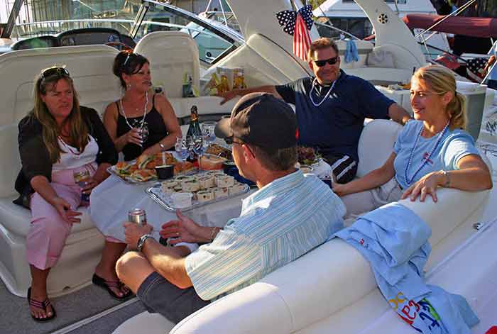
Cocktails in the cockpit. (Photo: Gene Beley)
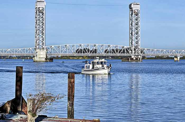
Rio Vista Bridge is lowered. (Photo: Pat Rains)
Lovingly restored vintage Chris Craft. (Photo: Gene Beley)
The town of Rio Vista lies to port, and straight ahead is the landmark Rio Vista Lift Bridge: 14 feet of vertical clearance when down, 144 feet when up. A mile later, the main stream of the Sacramento peels off to the east, now a much narrower waterway but with 10-foot minimum depth and dozens of feeder streams, creeks, and sloughs to explore. The Isleton bascule bridge below Walnut Grove has 15-foot vertical clearance at high water. Here, taller boats may need to wait 15 minutes or toot for an opening. The Delta Loop has been a favorite destination for larger cruising yachts, thanks to deeper water and bigger docks. In fact, a boat drawing as much as 10 feet can start at San Francisco and meander through the Delta to arrive at Sacramento's historic waterfront two weeks later — a terrific family vacation! Smaller boats have an advantage: They can navigate all the Sacramento River waterways mentioned above, plus they can explore the meandering San Joaquin and the four twisting forks of the Mokelumne River. In the San Joaquin main stream, maximum depths reach nine feet in some spots. Boats from the St. Francis Yacht Club, next to the Golden Gate Bridge, frequent the club's private Tinsley Island, which has nine feet of water off its north side and lies only five miles west of Stockton.
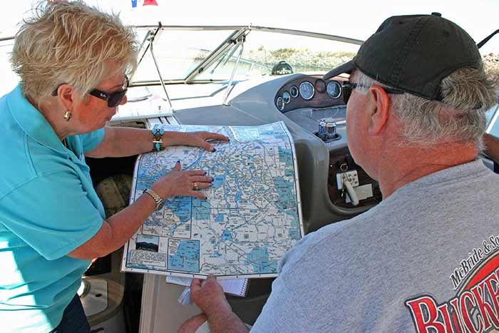
Charts with depths and bridge heights make it easy to plan your voyage through the maze of Delta waterways. (Photo: Gene Beley)
In the middle Delta, boats drawing less than eight-and-a-half feet can use the cross-channel gates to navigate from the Sacramento to the rest of the Delta. In all river systems, some side streams flow downhill for maybe a mile, then fade into tules, which are marshy no-wake lakes that create pristine fishing, kayaking, and bird-watching.
"It's all about the journey, not the destination," reads a hand-lettered sign in a remote Delta anchorage. Note that recreational boats shouldn't enter the Sacramento Deep-Water Ship Channel, which starts four miles north of Rio Vista.
Charts and Guidebooks
Planning your Delta vacation starts with charts showing water depths and bridge elevations, because your boat's draft and height will shape your itinerary. The following charts are useful for planning and navigating.
NOAA charts No. 18660 through No. 18663 cover the Sacramento River and the San Joaquin River.
The Delta: Suisun Bay, Sacramento and San Joaquin Rivers, published by Fish-n-Map Company is a foldout waterproof chart with GPS data.
The Sacramento River Boating Guide by Bill Corp contains 43 large-scale charts and reams of local knowledge and covers Rio Vista to Knights Landing.
"The California Delta Boaters Map and Visitors Guide," from the Sacramento Chamber of Commerce, is an accurate foldout chart that shows local boating services on the reverse.
Get tide charts online or at any marina or tackle shop; you'll need this information because most of the Delta waterways are tidal. The Coast Guard 11th District weekly Local Notice to Mariners has details about temporary drought and flood barriers.
Purchase a laminated San Joaquin River and Delta Navigation Chart (79) from Waterproof Charts. Even better, BoatUS Members can save on Waterproof Charts, check out the "Resources" page in your account to learn more.
Gold Rush Glory
Gold fever struck in 1849 at Sutter's Mill, on the American River, a feeder stream of the mighty Sacramento. By 1850, as many as 28 steam-driven paddle wheelers were carrying hundreds of prospectors upstream from San Francisco, a week's voyage. Today, Sutter's Fort State Historical Park isn't far from eight marinas in downtown Sacramento. The restored 1890 Delta Queen paddle wheeler is now a landmark restaurant. You'll also find Sutter Creek, Sutter Island, Prospect Island, Whiskey Creek, Miner Slough, and Steamboat Landing on Steamboat Slough.
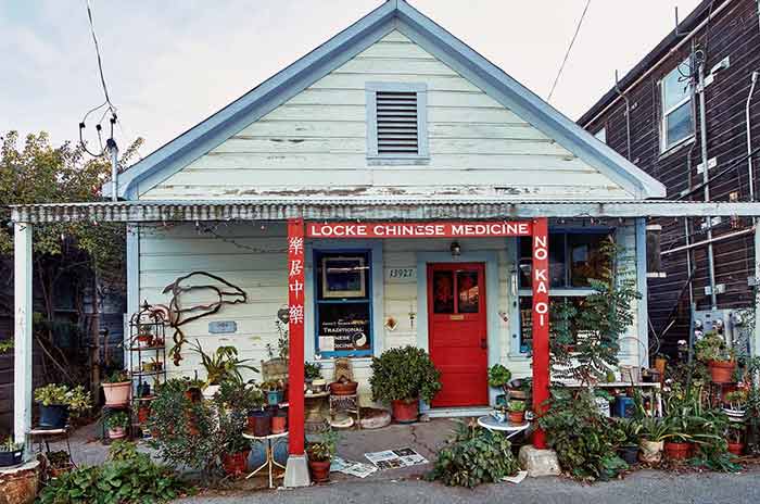
The Chinese Medicine Store in Locke has a 150-year history. The whole village is a living museum from Gold Rush glory days. (Photo: Pat Rains)
Chinese immigrants came to pan for nuggets in the gold streams, but many stayed through the 1890s to build the Pacific Railroad. In 1918, a few of the more successful Chinese businessmen bought a chunk of the Delta near Railroad Cut, off the Sacramento River. There they built their own town, now called Locke. It has always been an island of Chinese culture on the frontier.
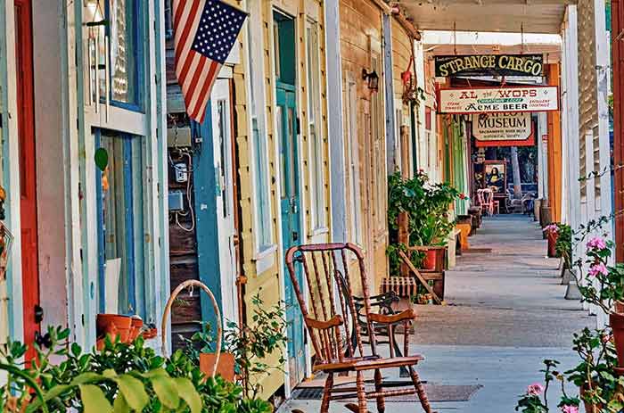
Main Street in the sleepy Gold Rush village of Lock. Come on and set a spell.
Today, Locke's three historic streets are preserved as a National Historic Landmark, drawing intrepid sightseers to visit the Chinese Herbal Medicine shop, the Dai Loy museum, or to have their fortunes told while eating banana splits at the Lockport Grill and Fountain. Boaters who dock at Walnut Grove Public Marina can walk the few hundred yards to explore Locke.
Many of the islands in the lower Delta (Frank's Tract, New Hope Tract, Empire Tract) were land grants also purchased by prospectors who'd gotten rich quick in the gold fields. In fact, most of the islands you see today were dredged up from the tule marshes that had flooded naturally for eons. Levees were created by dredges to shield the fertile farm islands from annual flooding. Dredging was so critical to the Delta's existence that Rio Vista has a whole little museum devoted to the steam-powered clam-shell dredge.
California Delta Events
January
Frozen Bun Run
Rusty Porthole Restaurant
Bethel Island, CA
February
Delta Loop Crab Feed
Lighthouse Resort
Isleton, CA
March
Clean Up Weekend
Marina West Yacht Club
Iselton, CA
April
San Joaquin Asparagus Festival
San Joaquin County Fairgrounds
Stockton, CA
Opening Day on the Delta
San Joaquin Yacht Club
Bethel Island, CA
May
Delta Loop Fest
Iselton, CA
Riverview Cruise In
Marina West Yacht Club
Iselton, CA
June
Cajun & Blues Festival
E2 Family Winery
Lodi, CA
July
Annual Barron Hilton Fireworks
Mandeville Island, CA
Courtland Pear Fair
Courtland, CA
September
50's Bash
Bethel Ialand, CA
October
Rio Vista Bass Derby & Festival
Rio Vista, CA
November
Chili Cookoff
Oxbow Yacht Club/Marina West Yacht Club
Iselton, CA
December
Delta Reflections Lighted Boat Parade
Stockton, CA
New Gold
"Delta Gold" these days refers to boutique red wines produced by 10 family-operated vineyards around Clarksburg and Lodi. The Old Sugar Mill, once a real sugar mill facility on the Sacramento River, now houses several restaurants where you can sample and buy all the local wines.
During Prohibition, whiskey was golden. In 1927, some successful mobsters built the Ryde Hotel in Art Deco style, complete with a bordello, barber shop, and secret tunnels out to the river. Celebrity photos line the walls, and the gardens serve as a wedding venue with a small riverboat landing. You can still check out the bootleggers' tunnels.
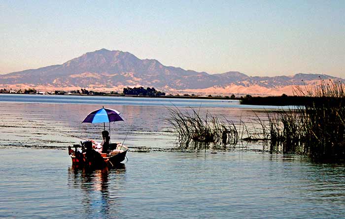
Mount Diablo rises northwest of the Delta, a handy landmark on the water. (Photo: Pat Rains)
The waters of the Sacramento River are becoming more valuable than gold or booze. Water districts of Los Angeles have been lobbying the state to let them buy water, drain it out through huge tunnels, and ship it 400 miles south. At the same time, farmers and ranchers around Fresno and Bakersfield are asking for their water share to be preserved. You'll see signs reading "Save the Delta" and "No Water, No Food" along major highways.
California Delta Boat Rentals
Delta Watercraft
Bethel Island, CA
(925) 684-2620
H2O Craft Rentals
Tracy, CA
(800) 979-RENT(7368)
Invert Sports
Bethel Island, CA
(888) 205-7119
Kokopelli Kayaks
Isleton, CA
(707) 365-3865
(925) 788-2103
Yachts for Charter
Opportunity Cruises
Stockton, CA
(916) 600-3815
Sacramento Historic River Cruises
Sacramento, CA
(888) 467-6256
Local Knowledge
"I'm all for leaving the Delta water in the Delta," said Nikki Seward, owner of Snug Harbor Resort and Marina on Steamboat Slough. Seward, a history buff, donated her family's collection of antique charts, maps, books, and documents of the Delta's colorful origins to the fledgling museum in Walnut Grove. "I'm more worried about the darned invaders," she said. Indeed. Two invasive plant species (water hyacinth and Brazilian waterweed) threaten the Delta with their explosive growth. Water hyacinth floats in thick mats that can foul props, rudders, or impellors and can suffocate fish habitats. The California State Parks Department of Boating and Waterways (Cal DBW) now sprays herbicides directly on the weeds in small sections of waterway. Spraying times and locations are posted on Local Notice to Mariners from the U.S. Coast Guard.
Yacht clubs have formal Opening Days, even though boating is a year round passion in the Delta. (Photo: Pat Rains)
For real local knowledge, just ask a friendly local: When I asked a fisherman at Wimpy's Marina, on the Mokelumne, for directions to the wildlife refuge at Stone Lakes, which I knew was about 10 miles north, he replied, "You wanna see sandhill cranes? Just take your next left." Sure enough, on nearby Staten Island we were surrounded by 5,000 sandhill cranes — all honking and strutting and ignoring my presence. Clouds of these giant birds were circling overhead, yet we were miles from the nearest official refuge. Local knowledge. Thanks to farmers who voluntarily open their levees and flood their fallow fields in winter, huge flocks of sandhills from the Arctic now stop here to rest, then stay all winter to feed and breed. The best time to see them is November through March.
Yes, boaters can easily spend two weeks exploring the California Delta — different parts at different seasons, year after year, generation after generation.