Advertisement
Reaching paradise never comes easy. This veteran of the Bahamas liveaboard life shows how it's done.
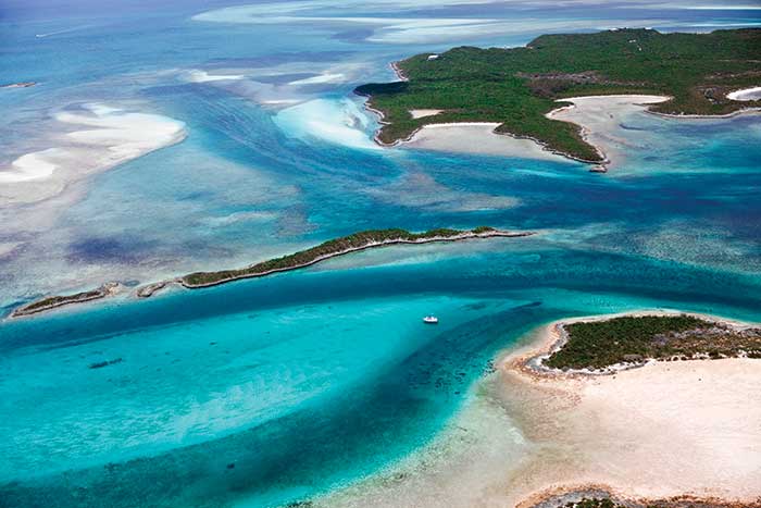
An aerial view of the Exumas. (Photo: Onne van der Wal)
They say that no one knows the exact number of islands in the Bahamas. Some say that there are around 2,400 of them, scattered about a stunning 590-mile-long archipelago, with its closest area being, for many boats, just one day's trip from Florida. Fewer than 50 of these islands have a village or town. Most are tiny islets with rocky shorelines and white beaches hinting of pink. Each is a gem of mangrove, casuarinas, palmetto, sea grape, and coconut palms hiding curly tail lizards, hermit crabs, and birds. But it's the wonderland of the ocean that is the Bahamas' most spectacular feature, with its warm turquoise waters over much of the shallow Bahama Banks.
On a good day, cruising on the banks, you can look into those clear waters and see fish, sharks, and rays darting away from your hull's shadow as it sweeps across the bottom. Below you, grass and fan coral sway with the current. Brain coral hides exotic fish, lobster, and moray eel. Dramatic troughs leading from the shallows out to sea — such as the Tongue of the Ocean and the Northwest Providence Channel — divide the banks, the changing water colors from light turquoise to deep blue leaving even seasoned world travelers in awe.
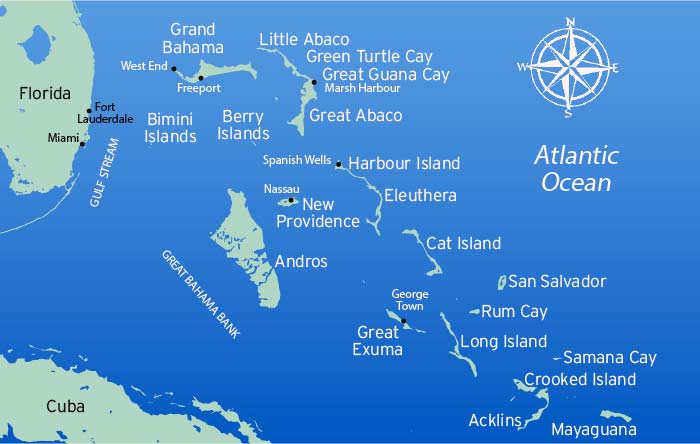
The islands of the Bahamas lie mostly along the edges of the banks. On some of the outer islands, mail and groceries arrive by boat, and telephone and electricity in homes are relatively recent developments. While some equate the Bahamas with the cities of Nassau or Freeport, the boater's dreams tend to be of islands a bit farther off, such as Long Island, Highborne Cay, Eleuthera, Royal Island, Green Turtle, Mayaguana, Ragged Island, Crooked Island, and the Jumentos — or islands with no names at all, except as they're known to locals, such as Chicken Cay or "His and Hers."
Getting Around And About
The culture, dialect, and pace are distinctly Caribbean, yet the western waters of the Bahamas are only a little over 40 miles from Florida at the closest point. That 40-plus miles is composed of the mighty Gulf Stream, a warm and powerful river in the ocean with current rushing from south to north. Crossing it in the right conditions can be a beautiful trip. But crossing it in the wrong conditions, such as during strong northerly winds, can be dangerous and extremely uncomfortable. Pick your weather carefully, look for flat calm or gentle southerlies, and never go on the verge of a cold front or storm.
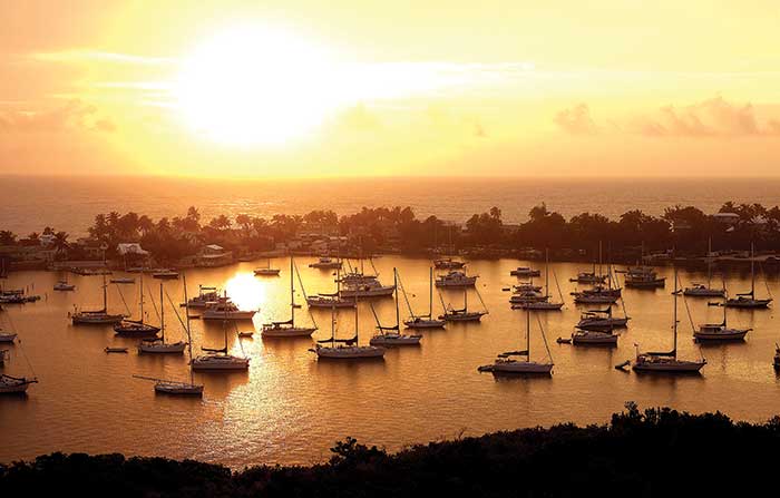
Snug all-weather anchorages are rare in the Bahamas, but when you find them, they offer camaraderie, supplies, and parties. (Photo: Onne van der Wal)
When my family and I first started going to the Bahamas many years ago, we followed a compass course and adjusted our routes to currents, wind, and waves. When we reckoned enough time had passed to raise an island, we searched the horizon. If we saw an island, we had to figure out which it was using landmarks, like clumps of trees or hills or colored cliffs. As we sailed in from deep ocean water onto to the shallow Bahama Banks, it was always a stunning moment as the depth sounder went from off soundings to 15 feet! We relied on the art of reading the colors of the water and the vagaries of the tidal currents by watching fan coral and sea grasses swaying to the flow under our boat — a fun endeavor, unless the light was poor or in our eyes.
Today, it's easier with GPS chartplotters. But you get in trouble if you rely too heavily on electronics. Sand shoals shift from year to year, and rocky bars and reefs may not be perfectly charted in the first place. A GPS fix is only as good as the chart you're relying on, and strong currents in inlets can set you onto rocks even as you watch your icon on the screen. And if your GPS equipment or the system isn't functioning well, you can get into trouble. The popularity of "crowdsourcing" doesn't necessarily work well in these waters, either; you never know the experience level of "the crowd" or the accuracy of their observations. Being a little off can put you on a reef.
Reliable guidebooks and paper charts are essential for Bahamas cruising. Otherwise, GPS waypoints extrapolated from mixed data may not be right on the spot. "Right on the spot" is critical when you're navigating an inlet that's only a few hundred feet wide with rocks and reefs around it and swells rolling in. Remember, Bahamas aids to navigation are rare and often not maintained.
Tip
Unlike the more forgiving waters of, say, Chesapeake Bay, the Bahamas are riddled with reefs, rocks, and brown bars (rocky ledges) that can quickly hole a boat, and there's no U.S. Coast Guard daily presence. There are some very good salvage firms, but the waters to which they must respond are vast. Lack of infrastructure means inconveniences and often long periods of time required for repairs. In many areas, there are few or no secure marinas or good anchorages available for storm protection. The Bahamas is mostly beautiful wilderness, so take care and navigate conservatively. To do so, you'll need the most reliable charts.
Sara and Monty Lewis began cruising the Bahamas more than 35 years ago. They produce and update The Explorer Chartbooks. Experienced cruisers swear by these Lewis charts. The waypoints provided are, they say, based on the Lewis team actually having gone to the rock, the deep part of the inlet, or the reef and recording the exact GPS reading while on site or verified with satellite photos or trusted advisers' data. Not only do they provide accurate full-color navigational charts, they also include cruising guide "need-to-know info" with informative articles and updated details on facilities and services throughout the Bahamas. (It's information from The Explorer Chartbooks that we heavily relied upon to bring you this article.)
Introducing The Bahamas By Region
Coming by boat, you'll probably get your first impression of the Bahamas from its western boundary. Here, the water and reefs are beautiful, and there are some anchorages for settled weather, as well as some marinas. Most of the small islands have rocky shores and lack good all-weather anchorages.
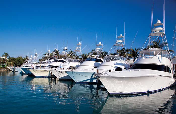
The Bimini Chain, a series of small cays (pronounced "keys") lies across the Gulf Stream from Miami and Fort Lauderdale. North and South Bimini and Cat Cay are settled. The mysterious stone slabs of the Bimini Road lie under nearby waters, fueling stories of Atlantis. Popular with the sportfishing fleet, Bimini has a village, several marinas, restaurants, and now a resort/casino and a Hilton Hotel.
Whether you prefer fishing Bimini's flats or heading out into the deep for bigger game, charters abound. (Photo: Bahamas Ministry of Tourism)
To accommodate those who want to experience the beauty, often the beauty is sacrificed. Bimini has suffered, in my view, as have many of the islands, from the negatives of tourism. In recent years, many of the mangroves on the northern end of Bimini have been replaced by resort development. On the west side, an ocean-docking facility for fast ferries from Miami was built from material dredged up from the ocean bottom. But the Biminis are still accommodating as far as clearing customs and stopping to rest in a marina before crossing the banks. With the tourism have come positives — better availability of parts and goods and better communications in Bimini and other settled areas.
To the north of the Bimini Chain, separated from it by the deep Northwest Providence Channel, is the large island of Grand Bahama, with resorts and marinas. At the far northwestern end of Grand Bahama, the critically located Old Bahama Bay Marina offers shelter for boats caught by weather, as well as many amenities.
Old Bahama Bay Marina at the northwestern end of Grand Bahama offers shelter to boats caught by weather, as well as many amenities for boaters. (Photo: Bahamas Ministry of Tourism)
Southeast of the Bimini Chain, across the Great Bahama Banks, lies the giant and mysterious island of Andros. Known as the bonefishing capital of The Bahamas, Andros's vast swamps, creeks, mangrove shallows, and miles of woods stretch more than 100 miles south to north, divided into three major sections of land connected by mangrove and tidal swamp. Scattered about are many of the famous "blue holes" of the Bahamas, some far inland from the shore, extending deep down, many connected with the ocean through a labyrinth of subterranean passages. Nearby, the recently discovered Andros Platform, a multitiered structure of huge, flat, squared blocks, remains silently under the waves, begging explanation.
With limited good anchorages, sparsely populated Andros hasn't experienced the large influx of cruising boats. The Great Bahama Banks blends with the shallows and swamp of its western shore, but its eastern shore faces the deep "Tongue of the Ocean" and has several towns with limited facilities, such as Morgan's Bluff, Fresh Creek, and Congo Town. One of the longest barrier reefs in the world guards this shore, allowing limited access. Andros, like so many other islands, is yet to be awakened, and many would say that's good.
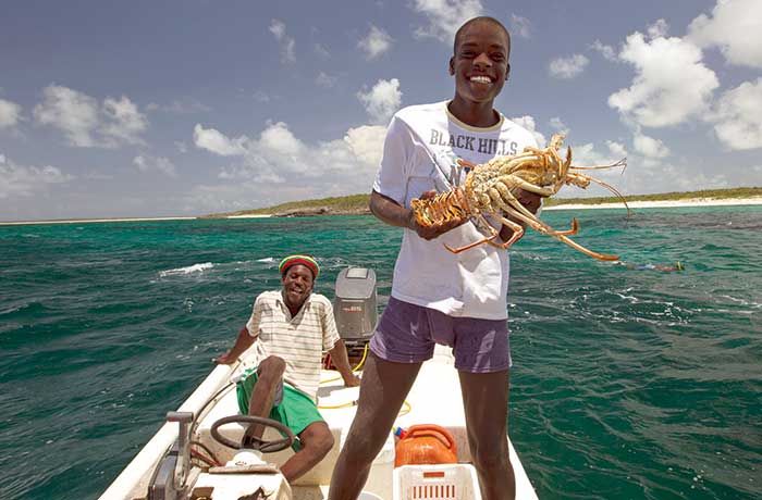
Spiny lobster season is August through March. (Photo: Bahamas Ministry of Tourism)
The Abacos is a great place for Bahamas exploration. While it is often considered more civilized than other areas, it's been affected less from tourism. Marinas, protected anchorages with good holding, shopping, good drinking water, restaurants, and small hotels make the area especially inviting. Many cruisers gravitate to the "Hub of the Abacos" with the towns and harbors of Man O'War, Hope Town, and Marsh Harbour. You can take short hops to different towns or anchorages across the shallow Sea of Abaco without going outside the reefs into the ocean. To the northwest of the Hub, and through sometimes-dangerous Whale Cay Passage, lies Green Turtle Cay with its several protected basins, marinas, and the town of New Plymouth with its quaint pastel homes similar to those of Man O'War and Hope Town.
The Berry Islands, known as "Der Berrys" by many Bahamians, are another expanse of small islands surrounded by shallow banks that rise from deep ocean. To the south and west of the busier Abacos, they aren't as heavily cruised because of their shallows and rolly anchorages, but this isolation makes them very attractive to some. Islands such as Great Stirrup, Great Harbor, Whale Cay, and Chub Cay rim the banks. Dinghy passages snake among white shoals and low-tide sand islands. It's easy to get lost. Only three marinas make bases for exploration. Chub Cay Marina is completely protected within an enclosed basin, recently reopened after hurricane damage, though not in full operation as of the date of this writing. Great Harbour Cay Marina also offers excellent shelter and is affordable, with more slips available for transients. In addition, the popular Berry Islands Club is also reopening its restaurant, rebuilding its docks, and fortifying its moorings after a hiatus. Always check ahead for any marina, to be sure it's currently open.
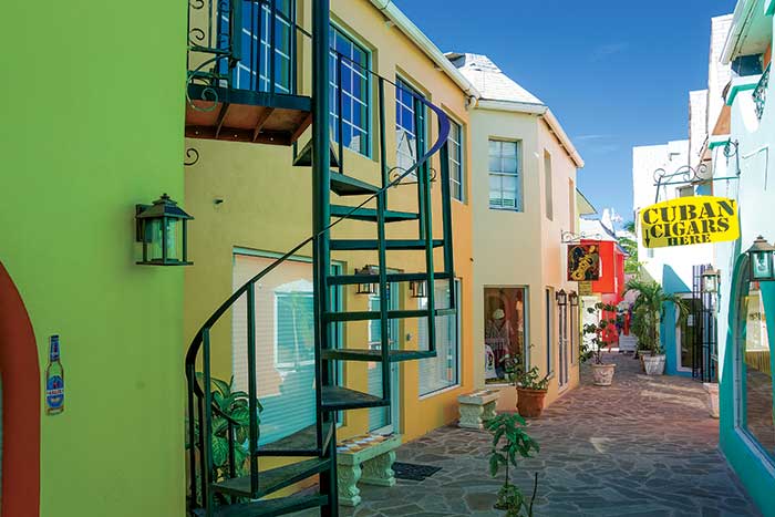
Downtown Nassau is known for its colorful architecture. (Photo: Bahamas Ministry of Tourism)
Many tourists consider Nassau to be synonymous with the Bahamas. Not hardly. This is the capital of the Bahamas and more than half the Bahamian population lives on its island of New Providence. It has the good and bad traits of most cities, with a distinctly Caribbean flavor, though reports of violent crime are increasing. Police in white uniforms direct traffic. Horse-drawn carriages commingle with cars, jitneys, and scooters. Buildings and customs reminiscent of the British Colonial Empire blend with things modern, overlaid with a significant share of poverty.
Nassau Harbour separates the "mainland" from Paradise Island, which has luxury hotels and casinos. The northwestern entrance to the harbor is deep and jettied, with several buoys. Huge cruise liners enter, but the inlet can be dangerous in strong onshore winds.
Tip
Anchoring isn't recommended in much of the harbor because of poor holding, strong currents, fast boats, wakes, and crime issues. There are several marinas; if Nassau has to be on your cruising itinerary, many boaters select a marina on Paradise Island. The southeastern entrance channel is only around 8 feet deep in one spot where coral heads and rocky bars dictate precise navigation.
To the southeast, the Exuma Cays curve in a northwest-southeast direction. The Exumas have only a few small all-weather marinas. Most anchorages are unprotected from westerlies, so they're only good for settled weather. The few that are sheltered from westerlies are between rocky islands and plagued by swift current and scoured bottom. The islands are generally rocky with low vegetation, sparse population, and a few villages. Nevertheless, each year more and more boats visit.
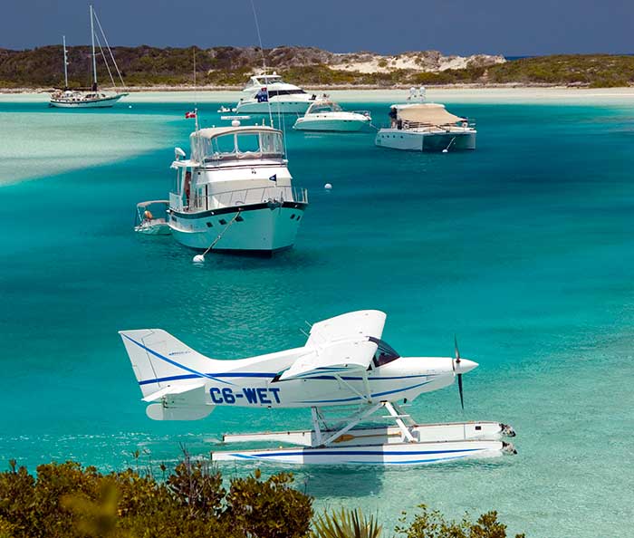
Cruisers lying to moorings in the beautiful and protected Exuma Cays Land and Sea Park. In many places, moorings are preferred or even required to avoid damage to the bottom and because of limited swinging room. (Photo: Bahamas Ministry of Tourism)
They've become so popular that celebrities and other wealthy people have purchased entire islands or large portions of them. It's reported that the Exuma Land and Sea Park, once a stronghold of environmental protection, now features such private islands, and personal watercraft from mega yachts often roar up and down the pristine channels. Staged "paradise" picnics on the beaches, replete with instant tents, bars, and lounges, entertain charter parties with all their water toys. Anchorages once enjoyed by a few are now becoming more crowded.
Heading down the chain, cruisers like to stop and enjoy the out-island friendliness of the small villages of Staniel Cay, Black Point, and Little Farmer's Cay. Village restaurants sometimes announce special menus on the VHF. Small grocery stores have limited supplies, and Staniel Cay's Isles General Store has marine and general hardware as well as groceries. And the Blue Store and the Pink Store have also expanded their stock to accommodate the greater number of cruisers and vacationers.
The Staniel Cay Yacht Club offers good meals, fuel, water purified by reverse osmosis, and a nice bar as well as cottage rentals. Indeed, the entire village is open to many home rentals. Fowl Cay Resort is one of several resort islands with rental houses and cottages, and it also has a restaurant available to the public by reservation. Snorkel into Thunderball Cave off Staniel and enjoy viewing thousands of protected fish. Part of the James Bond movie of that name was filmed here.
At the southern end of the Exumas, the "mainland" island of Great Exuma is a popular boating destination with a good but busy harbor. Its George Town boasts supplies and high island civilization. Exuma Market provides dinghy docking, town water, and other services while across Lake Victoria, the well-stocked Shop-Rite is another good choice for stocking. FedEx, UPS, boat supplies, and many other helpful goods and services are available. Almost 400 cruising boats are often in its Elizabeth Harbour for the annual spring Cruising Regatta, a weeklong festival run by the cruising community in conjunction with the Bahamian community.
Heading easterly from the Exumas you'll find more islands and variety. To the north, Eleuthera is known for its oranges and pineapples. Cruisers often visit the busy village of Spanish Wells with its fishing fleet, marinas, marine railways, and supplies. Harbour Island, guarded by the treacherous reef known as Devil's Backbone, is also popular for its pink sand beaches, quaint pastel-color buildings, the historic village of Dunmore Town, marinas, fishing, and relatively upscale living. Royal Island with its enclosed harbor broods with thick foliage and the silent ruins of a large estate. Years ago, wooden sailing ships of the British Navy sought shelter here; today cruisers wait for passage to the Abacos.
Tip
Cat Island, south of Eleuthera, stretches 48 miles, offering few anchorages but high hills, farms, villages, and miles of cliff and beach. To the south of Cat lies Long Island, with dangerous reefs extending more than 3 miles off Cape Santa Maria at its northern end. Never more than 4 miles wide, it's 75 miles long and features rolling hills and cliffs, fertile soil, and farming. A popular destination is Salt Pond and Thompson Bay on the west side, from where cruisers can tour the island by car and stock up at a modern grocery. Avoid anchorages exposed to weather and seas.
Far to the south and east, the "far out islands" rise from the deep ocean floor, beyond the banks. You'll find isolated jewels such as Rum Cay and Conception Island. Sumner Point Marina at Rum Cay has been closed due to hurricane damage as of this writing. As you venture farther southeast, more spectacular little islands with limited protection beckon with even more remoteness. These include Samana Cay, where Christopher Columbus is said to have anchored; Crooked Island; Acklins Island; Great Inagua with its famous flamingo population; and Mayaguana — all beautiful islands off the beaten track.
The Jumentos chain arches 90 miles around the southeast boundary of the Great Bahama Banks and has become more popular in recent years for experienced cruisers looking to find pristine islands as they once were. Many of these islands have little all-weather protection, tricky shallows, and few replenishing and stocking opportunities, but make up for it in sweet solitude
You Can't Always Get What You Want
The Bahamas, with their overwhelming beauty and thousands of square miles of ocean wilderness, offer a wonderful boating escape from the massive infrastructure and dense civilization of the States. But what makes them compelling also makes them challenging for unprepared boaters. Go soon if you can, take good care, and tread lightly.
Bahamas Fun Facts
- The Bahamas has the clearest water in the world. Visibility while diving is often more than 200 feet!
- Fewer than 50 of the islands have a village or town.
- The Bahamas has the world's third-longest barrier reef.
- Dean's Blue Hole, west of Clarence Town, Long Island, at 663 feet, is one of the deepest blue holes in the world.
- The first place Christopher Columbus landed when he came to the new world in 1492, he named San Salvador in the Bahamas.
- The word "mainland" is used by those on small outlying islands (called the Out Islands) to describe the larger islands, such as New Providence, Grand Bahama, Great Abaco, and Great Exuma. The "Far-Out Islands" are those even farther away.
- The world's longest underwater cave system can be found in Lucayan National Park, Grand Bahama Island.
- Kalik (pronounced "click"), the beer of The Bahamas, is named after the kalikking sound of cowbells at Junkanoo, the island street parades held every December 26.
- There are only about 396,000 people in all the Bahamas, the majority on the island of New Providence where Nassau is located.
- The national sport of the Bahamas is sloop sailing.
- Bahamas comes from the Spanish baja mar, which translates to "shallow sea."
Photo: Bahamas Ministry of Tourism
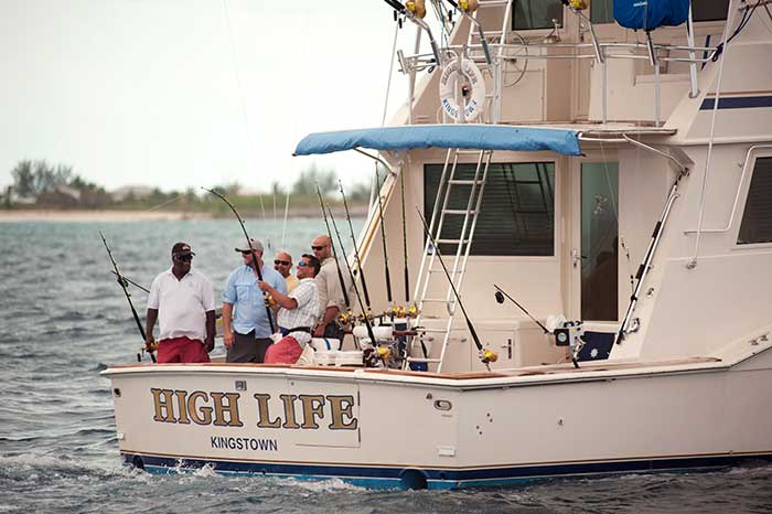
Chartering & Fishing
Power, Sail & Crewed Charters
- The Moorings (Abacos)
- Navtours (Nassau, George Town, Staniel Cay)
- Sunsail (Abacos, Nassau)
Sportfishing
- Boaters arriving on their own boats congregate around the marinas in Bimini, Nassau, Chub Cay, Boat Harbor, Highbourne Cay, and others.
- Note that fishing here is split between distinctively different offshore fishing and flats fishing (for bonefish).
- To join a sportfishing charter, search the Internet for numerous listings.
- Consider checking out one of the many fishing tournaments, listed at Bahamas.com/fishing-tournaments-2017.
Photo: Mel Neale
Anchoring Notes
- Never anchor in reef or anywhere your anchor rode may get tangled in coral.
- Leave 360-degree swing room for other boats, the shore, and reefs. Boats swing differently depending on their windage, bottom configuration, eddies, and current.
- The best bottoms consist of deep, soft white sand. You'll see these from the bow of your boat. Don't be misled by bottoms of white rock, marl, or shallow white sand over rock.
- Anchoring in grass usually results in dragging when the wind increases and damaging fish habitat.
- Nylon line can be cut by small rocks or reef. Use as much chain as your boat can safely carry.
- Don't anchor on a lee shore (the shore toward which the wind is blowing). Learn and watch the weather; plan your anchorage for 24 hours. It's not unusual for Bahamian winds to shift over that time.
- What starts as a protected anchorage could become a risky lee shore.
- Study an accurate weather forecast every day, and plan overnight anchorages accordingly.
Photo: Mel Neale
Weather Notes
- Obtain a detailed weather forecast every day. Heed it.
- Winter cold fronts are often preceded by strong southwesterly winds and come through as a strong, precipitous westerly, then nor'wester. Then winds often clock to a nor'easter and blow hard for days.
- "Squeeze plays" between large areas of high and large areas of low pressure may set up strong winds, usually from the east, for several days.
- The Bahamas offers little good protection in hurricanes and tropical lows. Even enclosed harbors are vulnerable with so little land to weaken the effects of wind and sea. Expect little help compared to U.S. waters.
Respect The 'Rage'
If there is a strong onshore swell, many cuts between islands and reefs become treacherous. The onshore swell may be caused by local onshore winds or from a far-off storm. At sea the swell may seem insignificant, but as it mounts up in the shallow waters near the cuts, it can become deadly. These swells can be far away when you leave the safety of your harbor in the morning but dangerously upon you when you want to enter the next inlet down-island. Watch the weather locally and far out. Ask ahead for current local conditions and knowledge. If any question exists about the safety of an inlet, don't risk it.
Search And Rescue
The Bahamas government has no search-and-rescue service equivalent to the U.S. Coast Guard. The Bahamas Air Sea Rescue Association (BASRA) is a dedicated nonprofit voluntary organization committed to saving the lives of distressed seamen and airmen in the Bahamas. It is funded by donations.
For boaters traveling off the beaten track, consider renting an EPIRB or PLB from the BoatUS Foundation before you go. Visit BoatUS.org for more information.
What Are Your Special Interests?
Looking to hang out with other cruisers? Consider the Hub of the Abacos. Several islands encircle the protected "Sea of Abaco" in which you can go from town to town in protected waters without going out through the reefs into the ocean. Towns include Marsh Harbour, Hope Town, Man O'War. A short hop in calm weather in the ocean fetches up Green Turtle Cay, and a trip south inside will bring you to Little Harbour, home of Pete's Pub and Foundry. There are more marinas in this area than in most other areas of the Bahamas.
Elizabeth Harbour lies near the southeastern end of the Exuma chain and has become a Mecca for cruisers with its relative protection (albeit with some open fetches) and good holding. Its bustling village of George Town is a vacation spot and an oasis of out island "high civilization," which hasn't lost its out-island charm. "In season," from December through March, there can be as many as 400 boats there, with all the potlucks and beach volleyball games you could want. The reefs guarding the entrances can be tricky; good weather and careful navigation are a must. Don't enter with a strong onshore wind or swell.
Looking for sport fishing? Alice Town on North Bimini offers several marinas, bars, restaurants, and good fishing offshore, with several tournaments throughout the year. Chub Cay, scheduled to be fully operational (after the ravages of Hurricane Mathew) has a marina in a completely enclosed harbor with restaurant, bars for bragging, and Customs. Fish offshore in the Tongue of the Ocean between the Berrys, New Providence, and the Great Bahama Banks.
Looking for remote experiences? What used to be remote may be more visited today, although features such as poor holding, little protection from wind and surge, and few provisioning opportunities still keeps the crowds away. You'll find unspoiled beauty and solitude in the Jumentos, Rum Cay (marina may not be rebuilt yet), the shallow banks of the Berrys (where people often explore by dinghy), and Conception Island. These areas have scarce protection, and require serious weather vigilance.
Looking for good diving and snorkeling? The Bahamas has the world's third-longest barrier reef. Five percent of the world's coral can be found there. Bring a light wetsuit, snorkel, mask, and fins for great snorkeling by dinghy throughout The Bahamas.
Looking for a show? Held at the end of April every year, the Family Island Regatta in Elizabeth Harbour is huge. Bahamians come from all the islands to compete, usually in traditional Bahamian boats. Also, the New Year's Day Regatta at Staniel Cay in the Exumas is fun, informal, and rollicking.